Jiajia Sun and Will Sager Awarded Research Grant by National Science Foundation
Artificial intelligence continues to cement its influence on the sciences. Geophysicists Jiajia Sun and Will Sager will use it to solve mysteries underneath ocean waters, specifically to understand the formation of enormous oceanic plateaus.

Sun, assistant professor of geophysics at the University of Houston’s College of Natural Sciences and Mathematics, is principal investigator of a $390,602, three-year grant from the National Science Foundation to study the origin of oceanic plateaus using machine learning, a type of artificial intelligence.
“We’re going to use machine learning to interpret marine magnetic data,” Sun said. “Despite its use in earth science, machine learning has not been used in this area of research. This will be a first-of-its-kind study.”
UH professor of geophysics Will Sager has studied oceanic plateaus and underwater volcanoes for most of his decades-long career.
“Oceanic plateaus are large, volcanic mountains that make up about 5% of the seafloor,” he said. “They represent the transfer of large quantities of magma from the mantle to the surface.”
These geologic formations can cover an area as large as Alaska and reach a thickness of several miles. Understanding their formation could help scientists get a clearer picture of Earth’s magmatic processes. However, oceanic plateaus are poorly understood, because they are miles underwater and often thousands of miles away from land.
That is where artificial intelligence steps in.

An Aim to Reduce Subjectivity
For years, scientists have gone out to sea to collect data from oceanic plateaus. These plateaus contain cooled magma, which forms a rock known as basalt. It contains magnetite, a mineral that is highly magnetic. Vessels floating above the plateaus can measure the magnetic field through magnetometers towed behind the ship. These measurements offer insights into the formation history of oceanic plateaus and the oceanic crust in general.
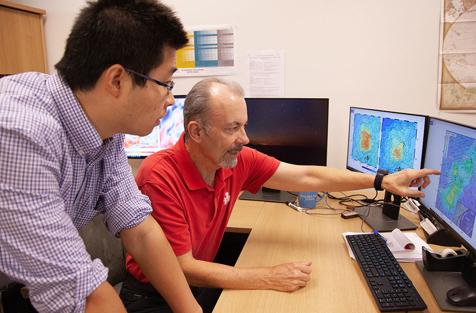
With the data, geophysicists create maps to interpret magnetic readings. However, interpreting the maps can be subjective, based on who is studying the data, and challenging, due to the lack of measurements in some areas.
Through computer algorithms, machine learning will be used to identify patterns in magnetic data, specifically to look for linear vs. nonlinear features in magnetic maps.
“At the core of magnetic interpretation is looking for patterns,” Sun said. “Machine learning is very good at recognizing patterns.”
Plateaus and Ridges Across the World
Two main theories exist to explain the formation of oceanic plateaus.

“One idea about oceanic plateau formation is that they are just huge volcanoes,” Sager explains. “As such, they form like a cake, one lava flow on top of another, building a huge volcano with the newest material at the top.”
Another idea says plateaus form laterally. As the Earth’s plates move apart, magma from the mantle comes to the surface. Sager said instead of building up a tall cake vertically, the plateaus grow by accumulation laterally, like the formation of the ocean crust at a mid-ocean ridge. The latter theory is Sager and Sun’s hypothesis.
The two will use data from three well-studied oceanic plateaus and two ocean ridges to test their hypothesis. This data will be analyzed by machine learning algorithms to look for patterns that one would expect from the ridges.
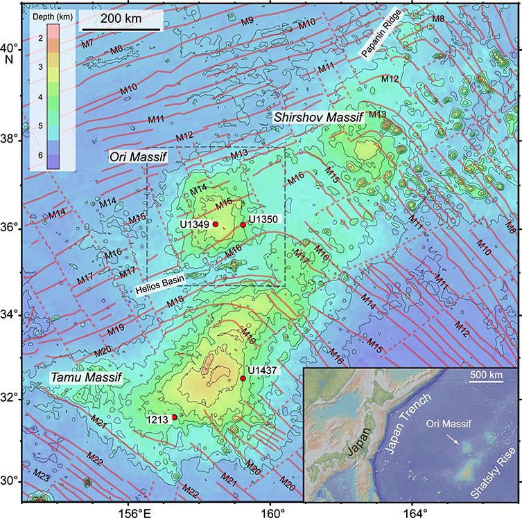
The three oceanic plateaus are Tamu Massif, an enormous plateau in the northwest Pacific Ocean, near Japan; Valdivia Bank, in the Atlantic, off the coast of Namibia; and Azores plateau in the North Atlantic, near the Azores islands. The two ocean ridges are East Pacific Rise and Mid-Atlantic Rise.
"These two mid ocean ridges are our benchmark,” said Sun. “We will compare data from the plateaus with them. If patterns in the plateau data look similar to those in the ridge data, then we can make a case for our theory.”
Machine Learning for Earth and Atmospheric Sciences Students
Machine learning will not only aid the geophysicists’ research, but they will use it to educate students at UH’s Department of Earth and Atmospheric Sciences. Students who work on the project will use artificial intelligence, a skill that is transferable to many fields.
A large part of the project includes application of several proven machine learning algorithms, said Sun. “All the data, all the code developed in this project, will be used in my undergraduate machine learning course to benefit more students and help train the next generation of the artificial intelligence workforce.”
Sun also plans to develop a similar course for graduate students in the earth and atmospheric sciences. Both courses will focus on experiential learning to help earth science students to develop artificial intelligence skills.
Both Sun and Sager believe this project and the courses it will benefit can help diversify UH earth and atmospheric sciences students’ educational and career opportunities. They said it will also attract young talent to the general field of earth sciences.
- Rebeca Trejo, College of Natural Sciences and Mathematics